01/01/2020 → 31/12/2022
PI in AU: Alexandros Iosifidis
coPI in AU: Erdal Kayacan
Programme: HORIZON 2020 - LEIT ICT WORK PROGRAMME 2018-2020
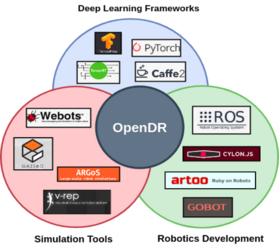
The core objective of OpenDR is to provide real-time (as defined by the specific use case requirements), light-weight (to be deployed in use-case specified embedded CPUs/GPUs like the NVIDIA TX1/2 and Xavier) and ultra light-weight (to be deployed in embedded architectures like Raspberry Pi, FPGAs, microcontrollers, etc.) deep learning architectures for performing inference and control in various robotics tasks.
AU Role: AU will lead a task on 2D/3D Object localization and tracking and will work on sensor information fusion, as well as contributing to object detection/recognition and semantic scene segmentation and understanding. AU will also contribute on a work package by working on deep person/face/body part active detection/recognition and pose estimation, deep person/face/body part tracking, human activity recognition, social signal analysis and recognition and multi-modal human centric perception and cognition. AU will also work on another work package on deep planning, deep navigation and deep action and control.
01/12/2020 → 1/12/2024
PI: Erdal Kayacan
Programme: HORIZON 2020 - H2020-MSCA-ITN-2020, European Union
01/06/2020 → 01/04/2021
PI: Erdal Kayacan
Programme: European Regional Development Fund
The aim of this project, in a collaboration with a start up company in Denmark, is to measure the distance between the harbour and the vessel when parking in the harbour using aerial robots.
01/08/2020 → 01/08/2021
PI: Erdal Kayacan
Programme: European Regional Development Fund
The aim of this project, in a collaboration with a start up company in Denmark, is the autonomous inspection vessels using visual SLAM algorithms in the harbour using aerial robots.


01/03/2019 → 31/12/2019
Project Coordinator: Erdal Kayacan
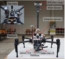
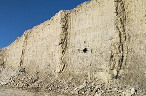
In order to generate 3D virtual maps of outcrops in geoscience, a manual flight of aerial robots is often employed which is challenging due to various reasons: 1) piloted flight over curved/uneven surfaces requires auto-focusing, 2) wind disturbances make it difficult even for skilled pilots to precisely main- tain the desired overlap, and 3) hiring of a skilled pilot is expensive as the outcrop generation requires hours of visualization data. In this work, we propose to fully automate the visualization process using a learning-based control framework, i.e., position tracking nonlinear model predictive controller in conjunction with Gaussian process (GP)-based disturbance regression which facilitates a precise tracking of the generated path. Thanks to the long-short term memory feature of the designed GP model, the disturbance forces are accurately estimated even for increasing magnitude levels and time-periods. The simulation and real-world tests manifest that the proposed method could provide a time- and cost-saving yet reliable visualization framework.